
Images


May 4, 2015 - Sediment in the Irish Sea
 Tweet
Tweet
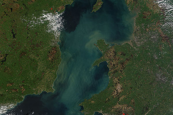
Sediment swirled in the Irish Sea in mid-April, 2015. The Moderate Resolution Imaging Spectroradiometer (MODIS) aboard NASA’s Terra satellite captured this true-color image on April 18.
The Irish Sea sits between the islands of Ireland and Great Britain, and is bounded by the North Channel in the north and St. George’s Channel in the south. It extends about 54,000 sq. km (20,850 sq. mi) and holds a volume of about 2800 cubic km (672 cubic mi). The Irish Sea is shallow, with an average depth of only about 52 meters (170 miles), but it drains a large area: 11,100 sq. km (4386 sq. mi) of Ireland and 34,500 sq. km (13,320 sq. mi) of the United Kingdom.
The flow of water from Ireland (to the west) and England (to the east) brings large amounts of sediment into the Irish Sea, especially after heavy storms or during spring rains. An example of increased sediment caused by runoff can be seen in the southeast section of the image, where muddy sediment can be seen spilling from the River Severn. But runoff is not the only source of sediment. The Irish Sea bottom is covered by a thick layer of mobile sediment of various types, from pebbles and cobbles to thick mud. The sediment in the eastern Irish Sea is particularly mobile and thick, giving rise to the name “the Mudbelt”.
Image Facts
Satellite:
Terra
Date Acquired: 4/18/2015
Resolutions:
1km (87.5 KB), 500m (335 KB), 250m (829.5 KB)
Bands Used: 1,4,3
Image Credit:
Jeff Schmaltz, MODIS Land Rapid Response Team, NASA GSFC
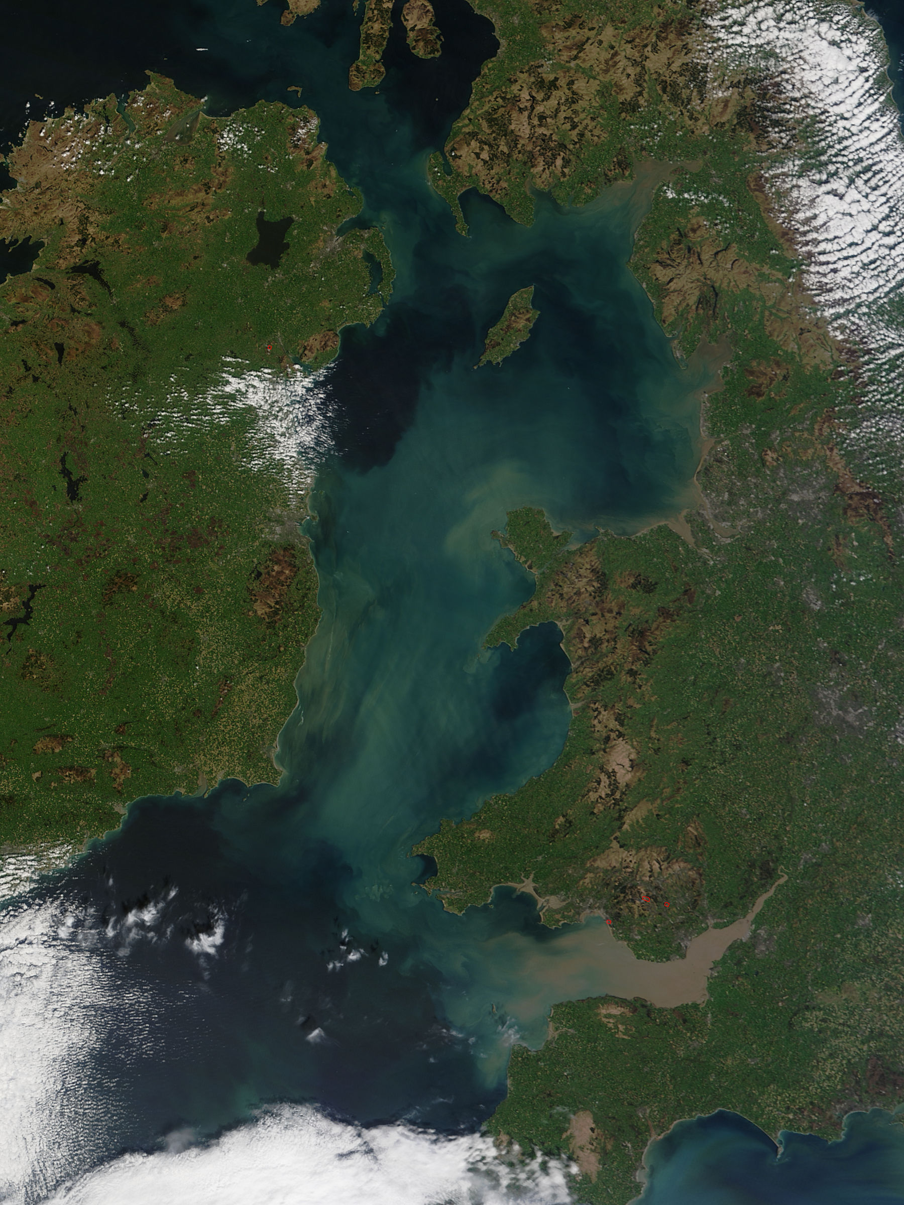
