
Images


April 25, 2015 - Western Europe
 Tweet
Tweet
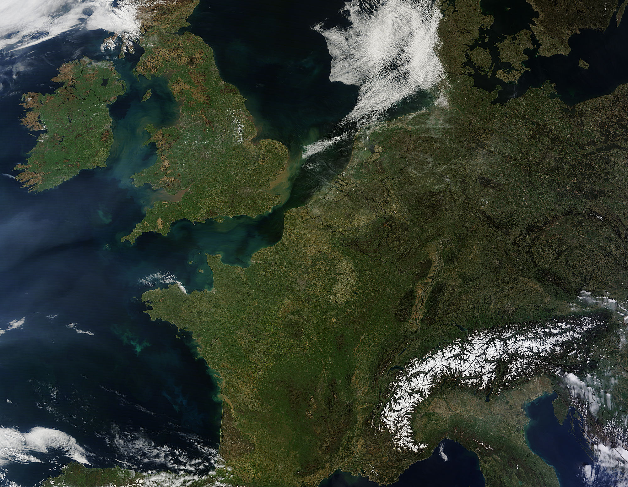
On April 21, 2015 NASA’s Terra satellite passed over Western Europe, allowing the Moderate Resolution Imaging Spectroradiometer (MODIS) aboard to capture a true-color image of the region.
In the northwest, Ireland’s spring vegetation has begun to color the country with emerald green. The black boundary line separates Ireland from Northern Ireland, which is politically part of the United Kingdom, along with Britain, to the east. The Irish Sea which separates the two is colored with sediment and also perhaps some phytoplankton blooms.
To the south, France occupies most of the image, although part of Spain can be seen in the southwest corner of the image. To the north, Luxembourg and Belgium border with France and to their north are the Netherlands, on the coast of the North Sea, while Germany lies inland.
While most of the land appears green with growing vegetation, the high peaks of the Alps, which stretch across Austria, Slovenia, Switzerland, Liechtenstein, Germany, France, Italy and Monaco, remain covered with winter’s snow.
Image Facts
Satellite:
Terra
Date Acquired: 4/21/2015
Resolutions:
1km (906.4 KB), 500m (3.4 MB), 250m (8.7 MB)
Bands Used: 1,4,3
Image Credit:
Jeff Schmaltz, MODIS Land Rapid Response Team, NASA GSFC
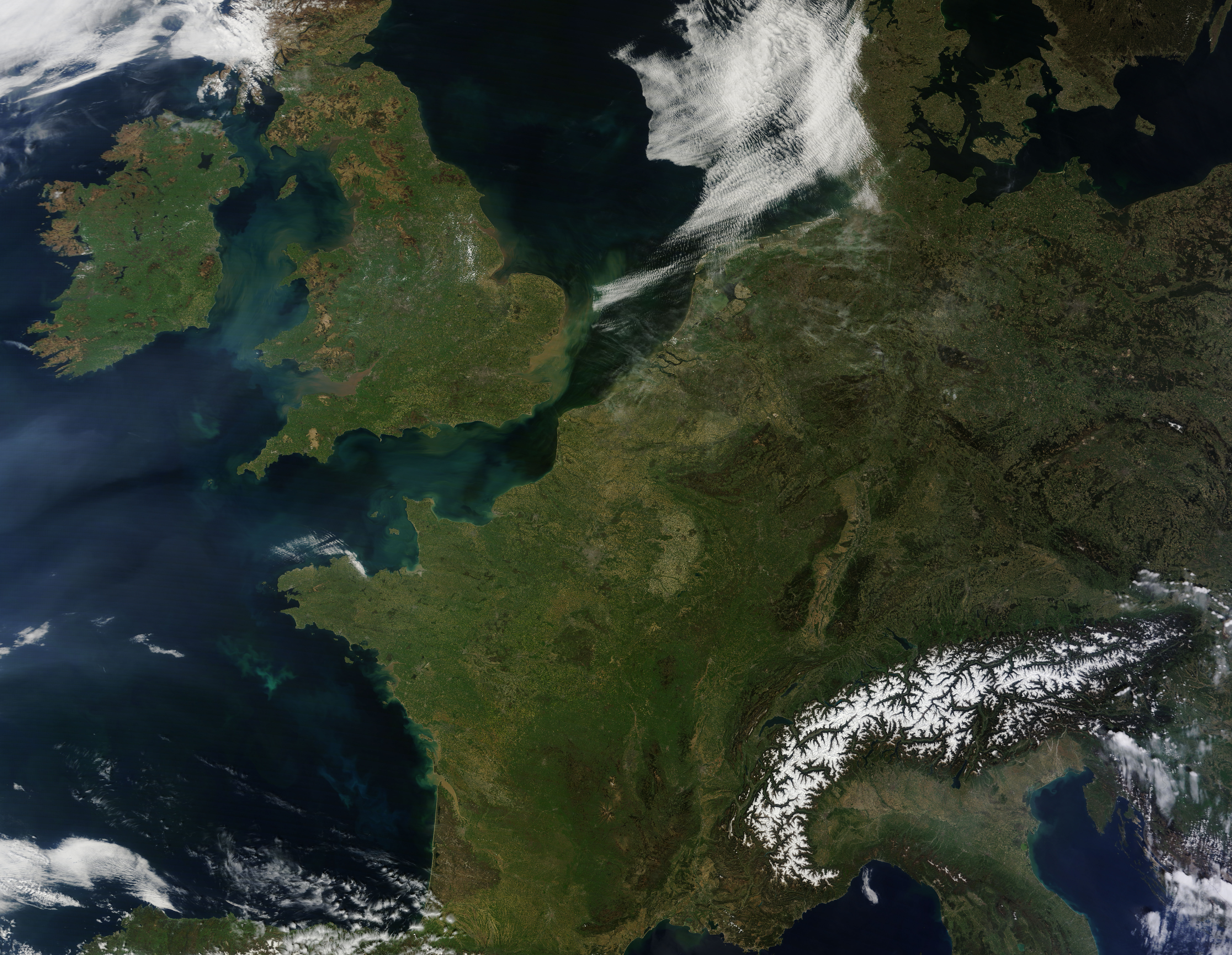
