
Images


April 24, 2015 - Fires around Tonle Sap, Cambodia
 Tweet
Tweet
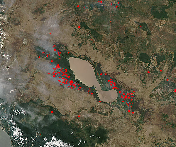
Fires surrounded the Tonle Sap Lake in Cambodia just north of Phnom Penh in early spring, 2015. This true-color satellite image was collected by the Moderate Resolution Imaging Spectroradiometer (MODIS) aboard the Aqua satellite on April 15. Actively burning areas, detected by MODIS’s thermal bands, are marked in red.
Most of the fires burn in grass or cropland, which appears tan in this image. Some fires also burn in the deep green forest that surrounds the Tonle Sap Lake.
The location, widespread nature, and number of fires suggest that these fires were deliberately set to manage land. Farmers often use fire to return nutrients to the soil and to clear the ground of unwanted plants. While fire helps enhance crops and grasses for pasture, the fires also produce smoke that degrades air quality. In Southeast Asia, the agricultural burning season usually runs from mid- to late-January, after the year’s primary crops are harvested, through April or May, when the next growing season begins.
Image Facts
Satellite:
Aqua
Date Acquired: 4/15/2015
Resolutions:
1km ( B), 500m (109.7 KB), 250m (268.6 KB)
Bands Used: 1,4,3
Image Credit:
Jeff Schmaltz, MODIS Land Rapid Response Team, NASA GSFC
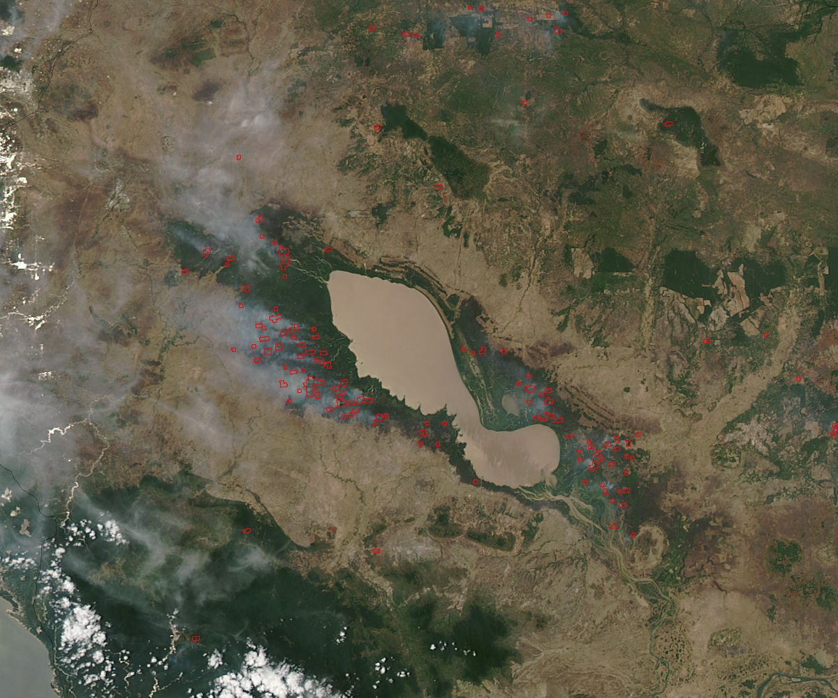
Fires surrounded the Tonle Sap Lake in Cambodia just north of Phnom Penh in early spring, 2015. This true-color satellite image was collected by the Moderate Resolution Imaging Spectroradiometer (MODIS) aboard the Aqua satellite on April 15. Actively burning areas, detected by MODIS’s thermal bands, are marked in red. Most of the fires burn in grass or cropland, which appears tan in this image. Some fires also burn in the deep green forest that surrounds the Tonle Sap Lake.
The location, widespread nature, and number of fires suggest that these fires were deliberately set to manage land. Farmers often use fire to return nutrients to the soil and to clear the ground of unwanted plants. While fire helps enhance crops and grasses for pasture, the fires also produce smoke that degrades air quality. In Southeast Asia, the agricultural burning season usually runs from mid- to late-January, after the year’s primary crops are harvested, through April or May, when the next growing season begins.
Image Facts
Satellite:
Aqua
Date Acquired: 4/15/2015
Resolutions:
1km ( B), 500m (109.7 KB), 250m (268.6 KB)
Bands Used: 1,4,3
Image Credit:
Jeff Schmaltz, MODIS Land Rapid Response Team, NASA GSFC
