
Images


April 14, 2015 - Princess Astrid Coast, Antarctica
 Tweet
Tweet
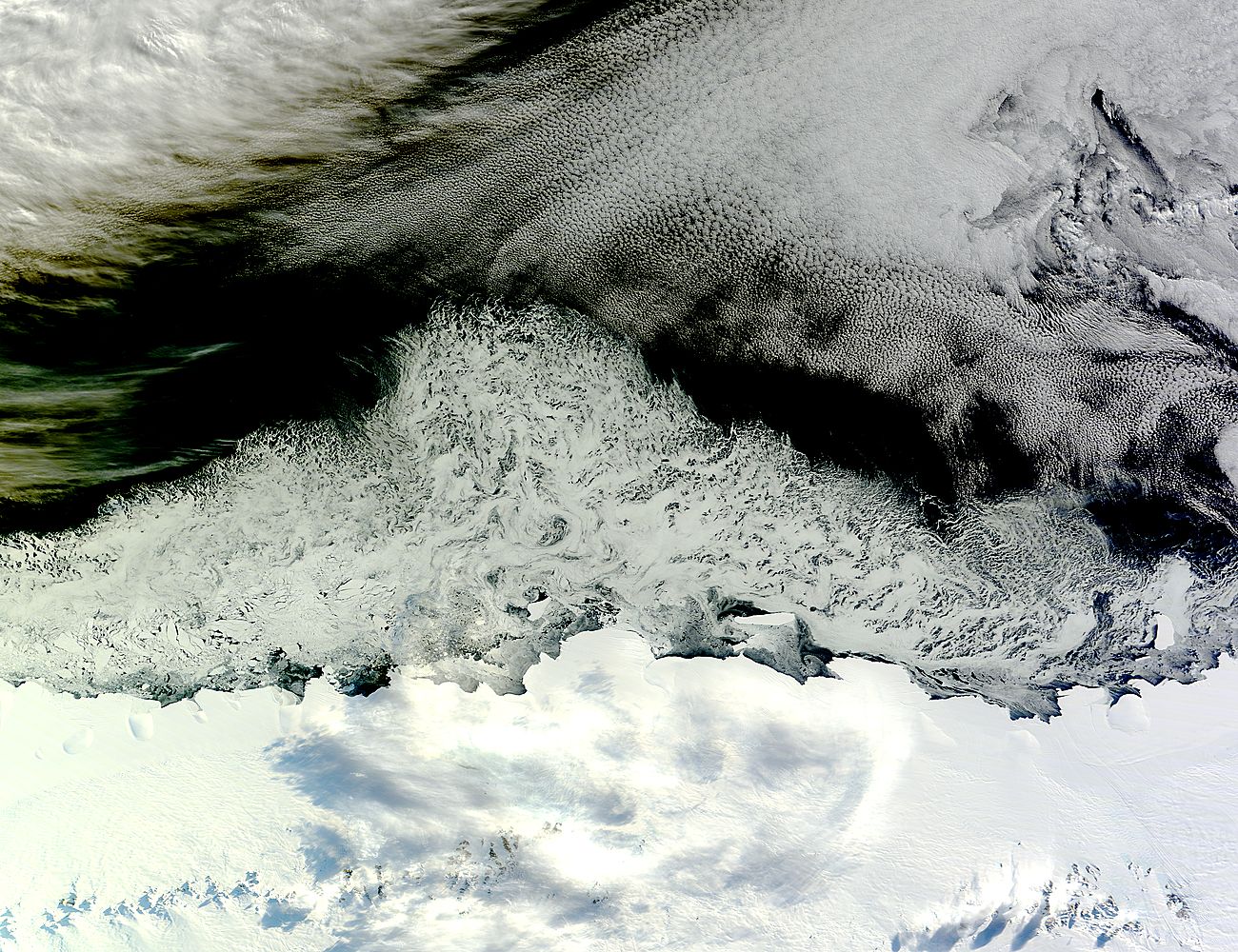
On April 5, 2015 the Moderate Resolution Imaging Spectroradiometer (MODIS) aboard NASA’s Terra satellite captured a true-color image of sea ice off the coast of East Antarctica’s Princess Astrid Coast.
The bright white area which stretches across the bottom of the image is the ice-and-snow-covered continent. Just off the coast the sea ice floats in the Southern Ocean, creating filigrees far offshore while close to shore the chunks of ice (icebergs) can be seen. Near the top of the image banks of cloud hang over the ocean, forming typical sweeping and popcorn-like patterns.
While true-color images give detailed views of the Earth, it can be difficult to definitively differentiate areas of similar color and reflectivity. In this image, the clouds at the top of the image, the sea ice, and the continent all have distinct patterns and reflectivity, so they appear different, although somewhat subtly so in some areas. Where cloud and ice are both in similar light, they blend together and are very difficult to distinguish. In such cases, the data from the instrument can be used to create a false-color image, in which very cold temperatures, such as ice and high cloud-tops appear bright green while lower clouds appear white.
An example of how cloud and ice may look very similar in true-color images is found in the lower part of this image. Small, white clouds hang over the Princess Astrid Coast. The colors of both ice and cloud are are very similar here, making it difficult to see the clouds. However, since the clouds are in the atmosphere above the Earth, light falling on them is blocked from the continent. This leaves gray-colored shadows, cast by the clouds, lying on the snow and ice.
Image Facts
Satellite:
Terra
Date Acquired: 4/5/2015
Resolutions:
1km (405.1 KB), 500m (1.4 MB), 250m (3.6 MB)
Bands Used: 1,4,3
Image Credit:
Jeff Schmaltz, MODIS Land Rapid Response Team, NASA GSFC
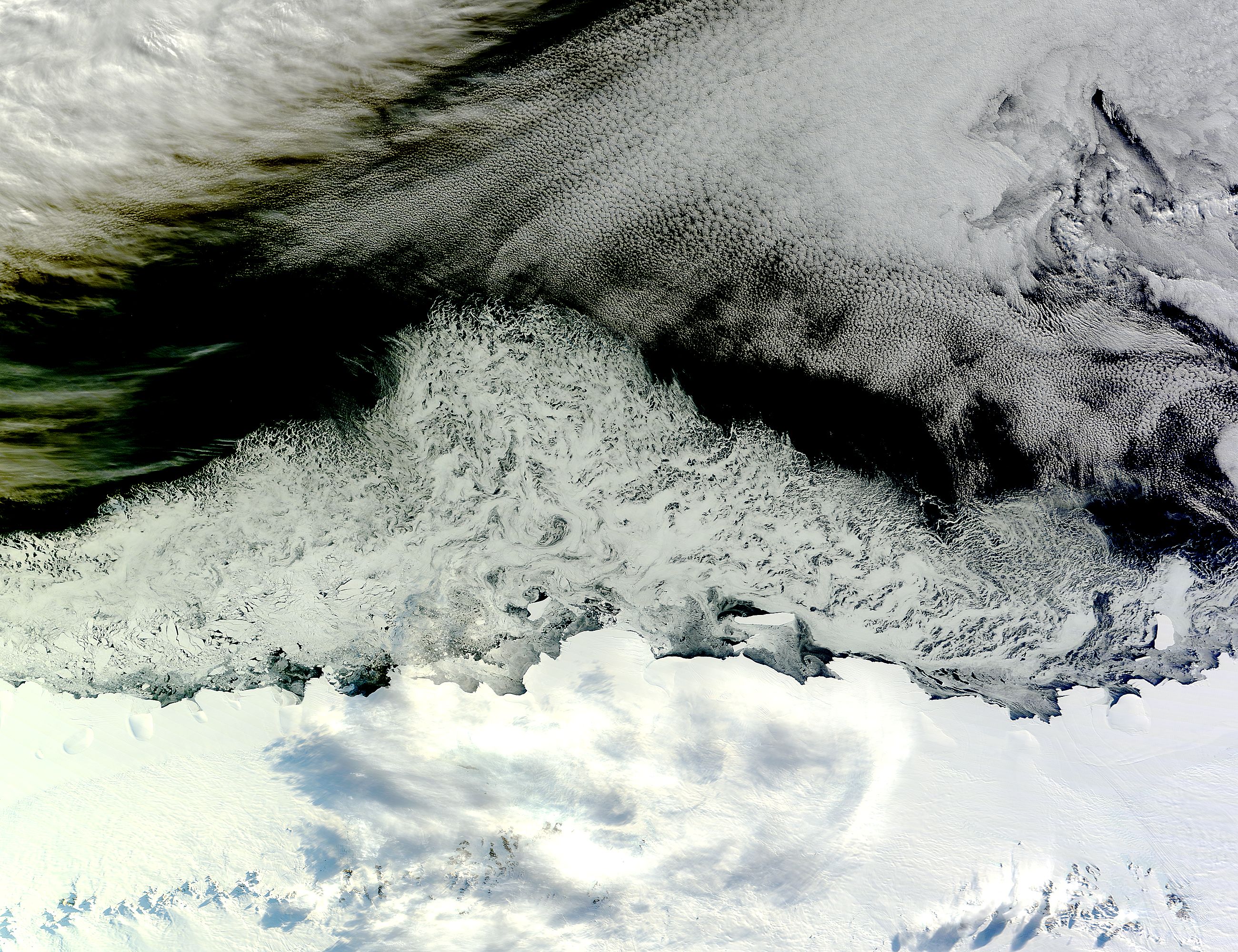
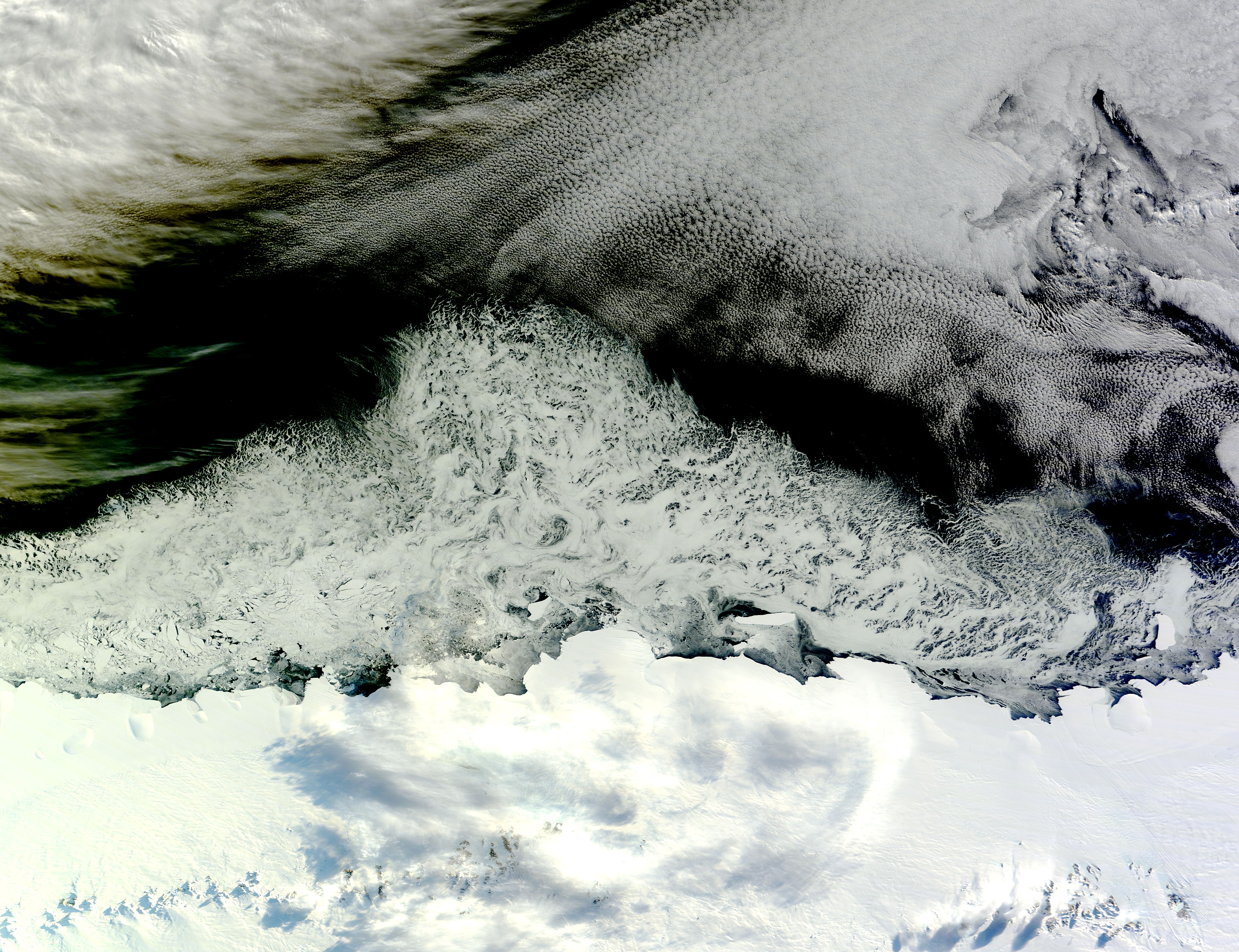
