
Images


March 28, 2015 - Dust storm off Libya
 Tweet
Tweet
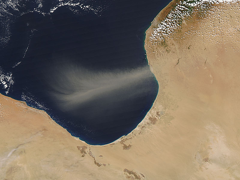
A long, tan plume of dust blew from Libya across the Gulf of Sidra in mid-March, 2015. The Moderate Resolution Imaging Spectroradiometer (MODIS) aboard NASA’s Aqua satellite captured this true-color image on March 19 as it passed over the region.
Green can be seen along a small section of Libya’s coast, partially hidden under popcorn clouds. This location is where a Mediterranean climate predominates and rainfall is adequate for agriculture. Only 1% of Libya’s land is arable, however, with dry desert stretching across most of the country.
Dust storms are a primary natural hazard in the country, and can have significant local effects. Large amounts of airborne dust contribute to air pollution, reduce visibility, cause airport closures, and increase the risk of traffic accidents. They also can reduce soil fertility, damage crops, decrease the efficiency of solar devices, and damage telecommunications equipment. On a larger scale, dust also affects water chemistry, provides the oceans with minerals and can affect marine food webs.
Image Facts
Satellite:
Aqua
Date Acquired: 3/19/2015
Resolutions:
1km (25 KB), 500m (87.4 KB), 250m (216.6 KB)
Bands Used: 1,4,3
Image Credit:
Jeff Schmaltz, MODIS Land Rapid Response Team, NASA GSFC
