
Images


March 22, 2015 - Dust storm in the Sahara
 Tweet
Tweet
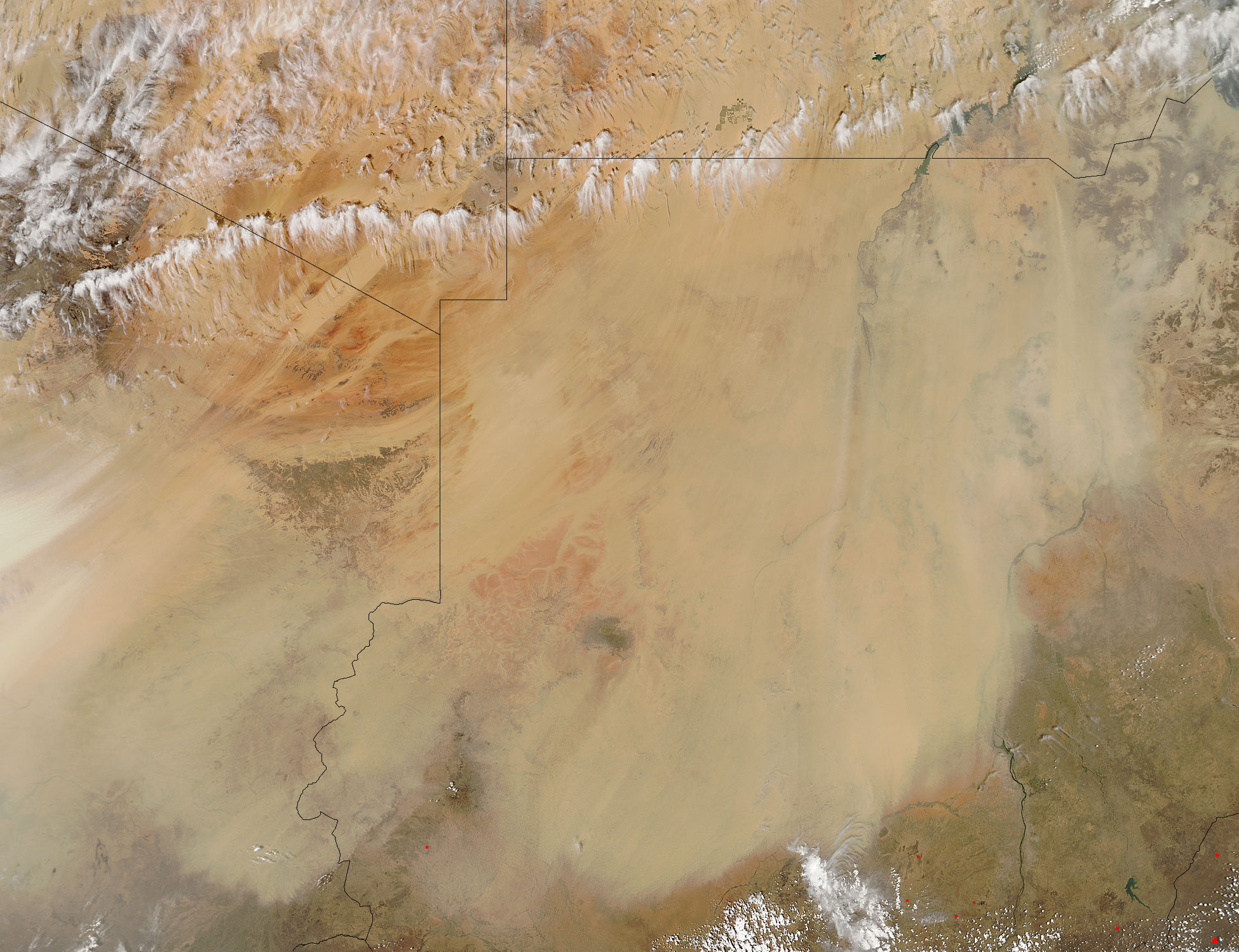
The Sahara Desert earns its nickname, the "Great Desert". It is the world’s largest hot desert, covering approximately 10% of the African continent and stretching from the Red Sea in the east to the Atlantic Ocean in the west. The desert surface contains stone plateaus, gravel plains, dry valleys, salt flats and vast areas of sand dunes.
When strong winds blow over the desert – as they frequently do – the dust and sand of the desert is easily lifted, resulting in frequent, sometimes massive, sandstorms. According to a study by a team of scientists led by NASA’s Hongbin Yu and published February 24, 2015 in Geophysical Research Letters, wind and weather pick up on average of 182 million tons of dust from this region each year – or over 689,000 semi truckloads of dust. Much of this dust is carried across the Atlantic Ocean, and about 27.7 million tons annually make it to the Amazon basin. Another 43 million tons of dust travels even further, to settle over the Caribbean Sea past longitude 75W.
The Moderate Resolution Imaging Spectroradiometer (MODIS) aboard NASA’s Aqua satellite captured this true-color image of a line of wind raising a massive cloud of Saharan dust. A broken line of clouds, most likely marking the leading edge of a frontal system, forms an arc across (from east to west), Egypt, Sudan, Libya and Chad. Behind the clouds the sky is clear and the landscape can be seen in detail. Ahead of the clouds, however, the landscape of Sudan and Chad is hidden beneath a thick blanket of tan dust.
Image Facts
Satellite:
Aqua
Date Acquired: 3/12/2015
Resolutions:
1km (511.4 KB), 500m (1.6 MB), 250m (3.9 MB)
Bands Used: 1,4,3
Image Credit:
Jeff Schmaltz, MODIS Land Rapid Response Team, NASA GSFC
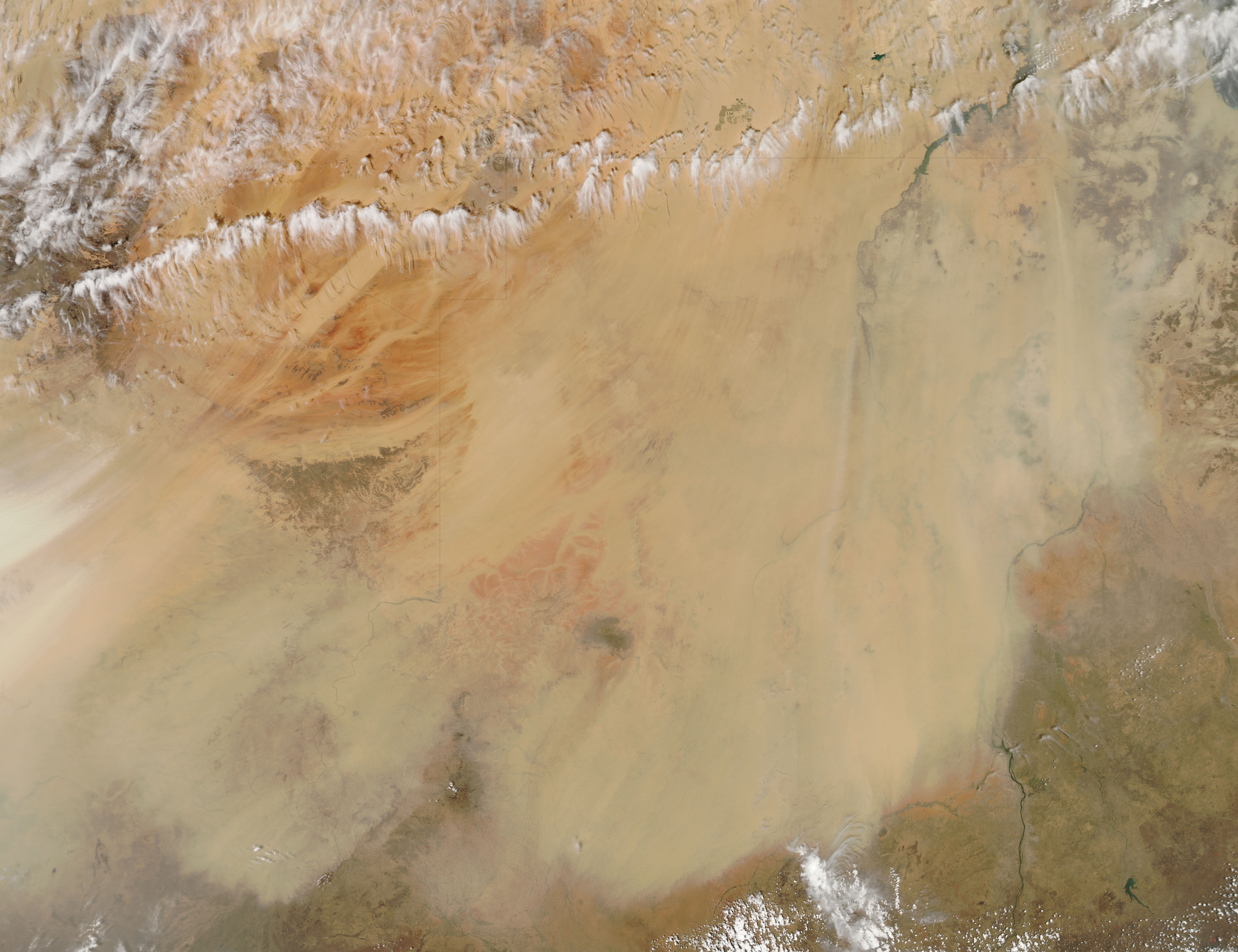
