
Images


March 21, 2015 - Northern Europe
 Tweet
Tweet
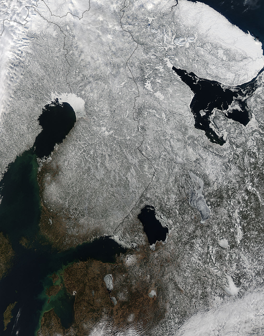
On March 12, 2015 NASA’s Aqua satellite swept over the wintery landscape of northern Europe. The Moderate Resolution Imaging Spectroradiometer (MODIS) aboard NASA’s Aqua satellite captured a true-color image of the region at 10:15 UTC (6:15 a.m. EDT) that same day.
A heavy layer of snow covers northern Norway (upper left corner of the image), northern Sweden, most of Finland, and northwestern Russia. Snow thins and disappears, leaving green vegetation visible, in the southern tip of Finland and, to the south, Estonia, Latvia and part of western Russia. The frozen lakes and rivers found across the region, especially in the northern regions, give evidence of long-term frigid temperatures. A heavy layer of sea ice remains in the northernmost reach of the Gulf of Bothnia. Much of this Gulf freezes every year, so the expanse of open water gives evidence of a warming trend as spring approaches.
Image Facts
Satellite:
Aqua
Date Acquired: 3/12/2015
Resolutions:
1km (638.8 KB), 500m (2.5 MB), 250m (6.4 MB)
Bands Used: 1,4,3
Image Credit:
Jeff Schmaltz, MODIS Land Rapid Response Team, NASA GSFC
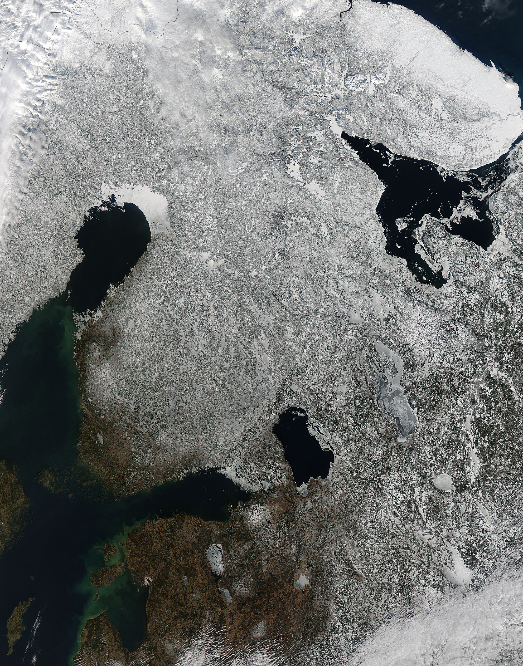
