
Images


January 27, 2015 - Tropical Cyclone Niko (07P) over the Society Islands
 Tweet
Tweet
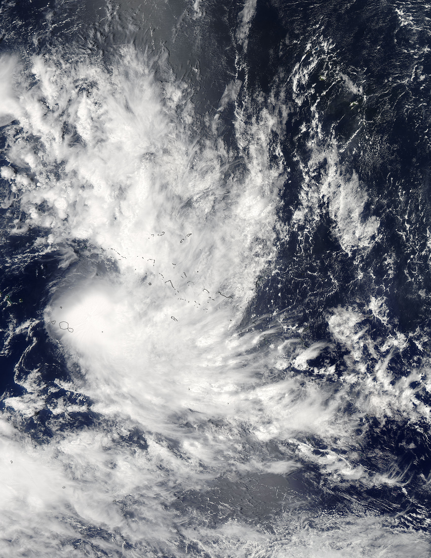
After making its social debut in the Southern Pacific Ocean, NASA's Aqua satellite spotted Tropical Cyclone Niko moving through the Society Islands.
NASA's Aqua satellite passed over Tropical Cyclone Niko on January 21 allowing the Moderate Resolution Imaging Spectroradiometer (MODIS) flying aboard to capture this true-color image of the storm. The MODIS image shows that the storm remains compact, while the strongest thunderstorms are pushed to the southeast of the center by northwesterly vertical wind shear.
On January 22 at 0900 UTC (4 a.m. EST), Tropical Cyclone Niko's maximum sustained winds were near 58 mph (93 km/h) and strengthening. Niko was centered near 18.1 south latitude and 147.6 west longitude, about 138 miles (222 km) east-southeast of Papeete, Tahiti. Niko was moving to the southeast at about 14 mph (22 km/h). Later that day, Niko’s maximum sustained winds peaked at about 63 mph (101 km/h) and held there until the afternoon of January 23. At that time, strong wind shear began to slow the storm. By the evening of January 24 Niko had become a Tropical Depression, with maximum sustained winds of only 29 mph (47 km/h). The Joint Typhoon Warning Center issued its last advisory on the storm that same day.
Image Facts
Satellite:
Aqua
Date Acquired: 1/21/2015
Resolutions:
1km (1.1 MB), 500m (3.8 MB), 250m (9 MB)
Bands Used: 1,4,3
Image Credit:
Jeff Schmaltz, MODIS Land Rapid Response Team, NASA GSFC
