
Images


January 25, 2015 - Sediment stirred up by Tropical Cyclone Bansi, Cargados Carajos Shoals, Indian Ocean
 Tweet
Tweet
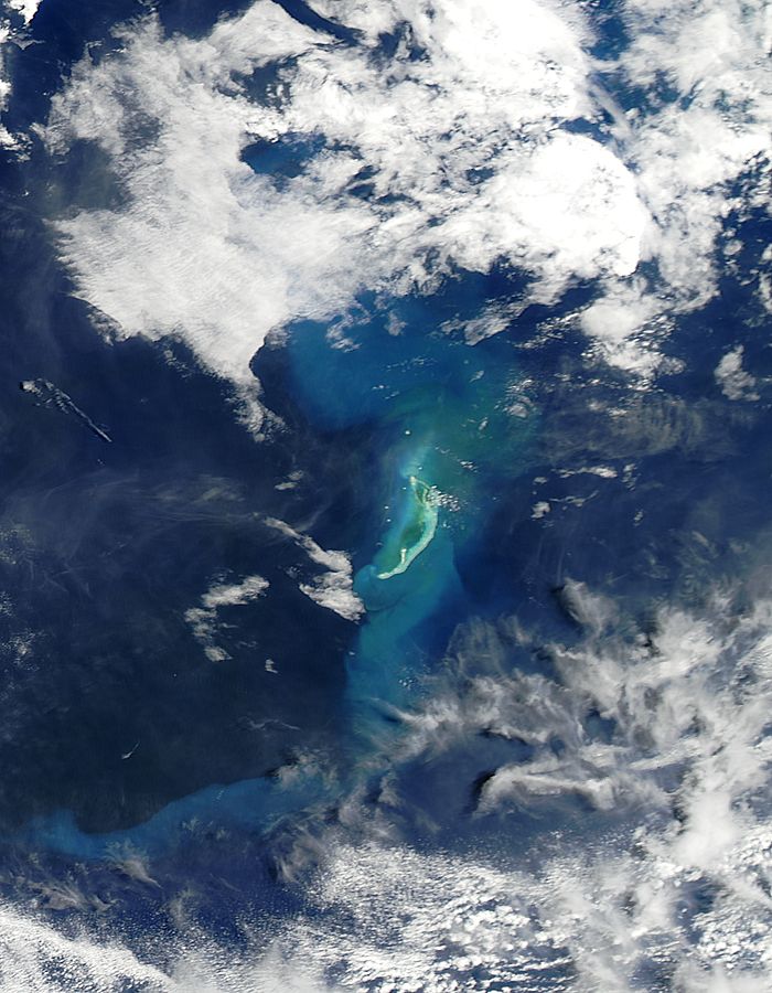
Tropical Cyclone Bansi reached a Category 4 status on the Saffir-Simpson Scale on January 15 and 16 as it moved through the Southern Indian Ocean. By January 19 as the storm was weakening over open ocean, NASA's Aqua satellite captured an image of sediment stirred up from the storm around the Cargados Carajos Shoals.
On January 15 at 0900 UTC (4 a.m. EST), Tropical Cyclone Bansi was a Category 4 hurricane on the Saffir-Simpson Scale with maximum sustained winds near 150 mph (241 km/h). At that time Bansi was centered about 519 miles (835 km) east of Port Louis, Mauritius.
On January 18 at 0900 UTC (4 a.m. EST) the time of the Joint Typhoon Warning Center's last bulletin on the system, Bansi's maximum sustained winds had dropped to 74 mph (120.4 km/h) and it was located 1,640 miles (2,639 km) southwest of Cocos Island. Later in the day, Bansi started extra-tropical transitioning and by January 19, it was a weaker extra-tropical cyclone moving over open waters of the Southern Indian Ocean.
On January 19 at 10:15 UTC (5:15 a.m. EST) when NASA's Aqua satellite passed over the Cargados Carajos Shoals, the Moderate Resolution Imaging Spectroradiometer (MODIS) instrument aboard captured this true-color image of the results of Bansi's powerful winds. The image showed sediment stirred up from the ocean bottom around the Shoals had colored the ocean waters around them.
According to Mauritiusattractions.com, Cargados Carajos Shoals is also known as Saint Brandon and consists of more than 50 islands, coral ridges and vast sand flats on an extended reef. It is located in the Southern Indian Ocean about 308 miles (496 km) north east of Mauritius.
Image Facts
Satellite:
Aqua
Date Acquired: 1/19/2015
Resolutions:
1km (43.1 KB), 500m (123.8 KB), 250m (273.6 KB)
Bands Used: 1,4,3
Image Credit:
Jeff Schmaltz, MODIS Land Rapid Response Team, NASA GSFC
