
Images


January 22, 2015 - Fires in Indochina
 Tweet
Tweet
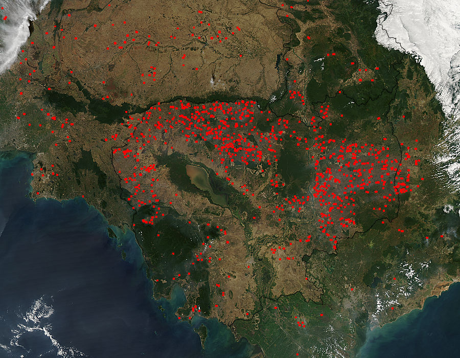
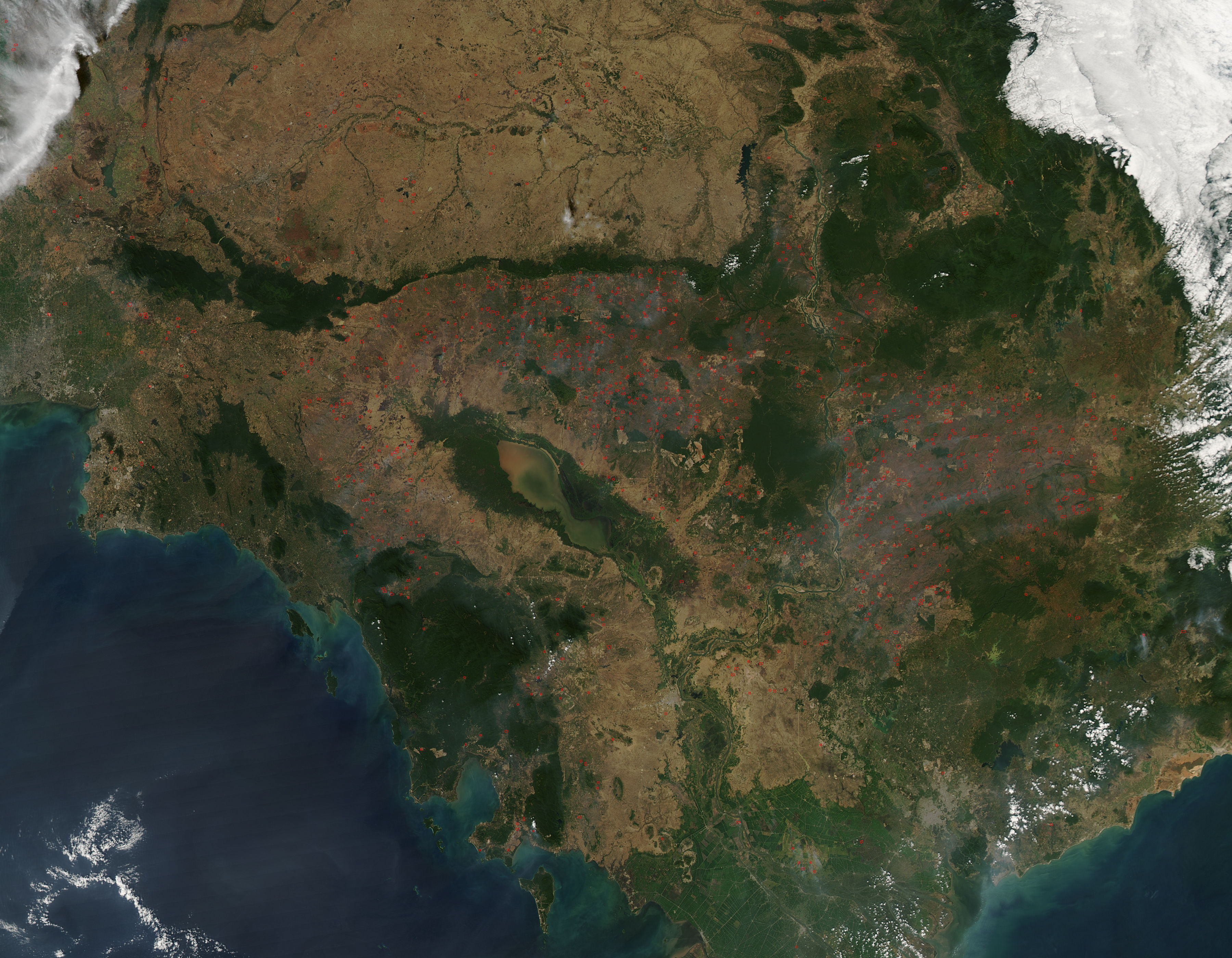
Hundreds of fires were detected burning in Indochina in mid-January, 2015. The Moderate Resolution Imaging Spectroradiometer (MODIS) aboard NASA’s Aqua satellite captured this true-color image on January 16 as it passed over the region.
Places where the thermal sensor detected active fires are outlined in red. The heaviest activity can be seen in Cambodia, with heavy clusters or red hotspots wrapping in an arc north and northwest of Tônlé Sab Lake. Intense activity also occurs in eastern Cambodia. A relatively few fires speckle the landscape of Thailand, which lies north and northwest of Cambodia. To the south and east, red hotspots also appear in Vietnam. In this true-color image, areas of dry winter grasses appear light tan, and the region’s remaining tropical forests appear dark green.
The widespread nature and the time of year suggest that these fires are primarily agricultural in origin, and used to manage cropland. Fires are also set in the forest regions for various reasons, such as to clear forest for crops, to maintain pasture, cropland and unimproved roads and paths. In addition, people set fires in the forest regions to increase the yield of natural resins that are produced by rainforest trees, to hunt, and to drive bees away from their hives so that honey can be collected.
Image Facts
Satellite:
Aqua
Date Acquired: 1/16/2015
Resolutions:
1km (222.7 KB), 500m (806.6 KB), 250m (2 MB)
Bands Used: 1,4,3
Image Credit:
Jeff Schmaltz, MODIS Land Rapid Response Team, NASA GSFC
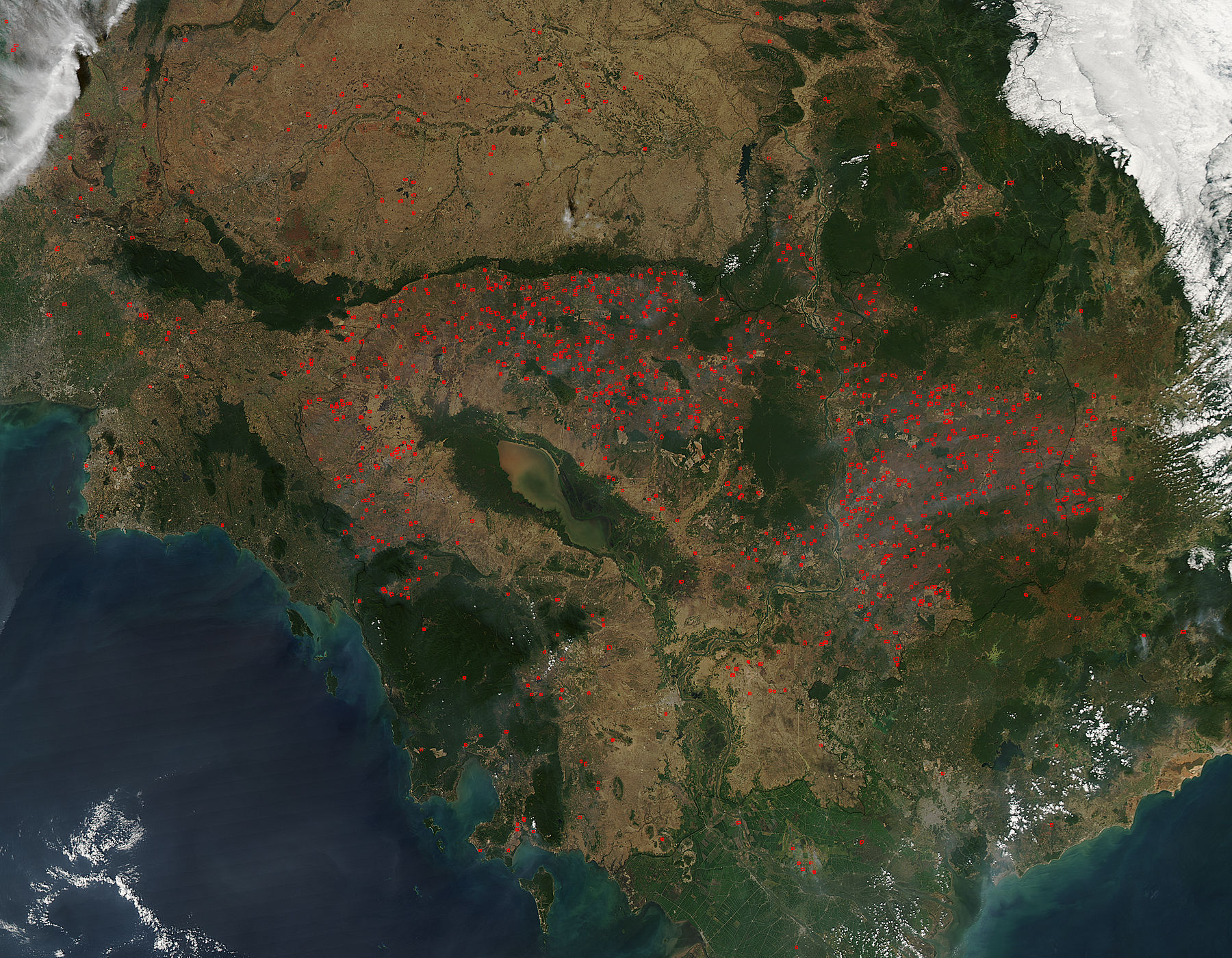
